
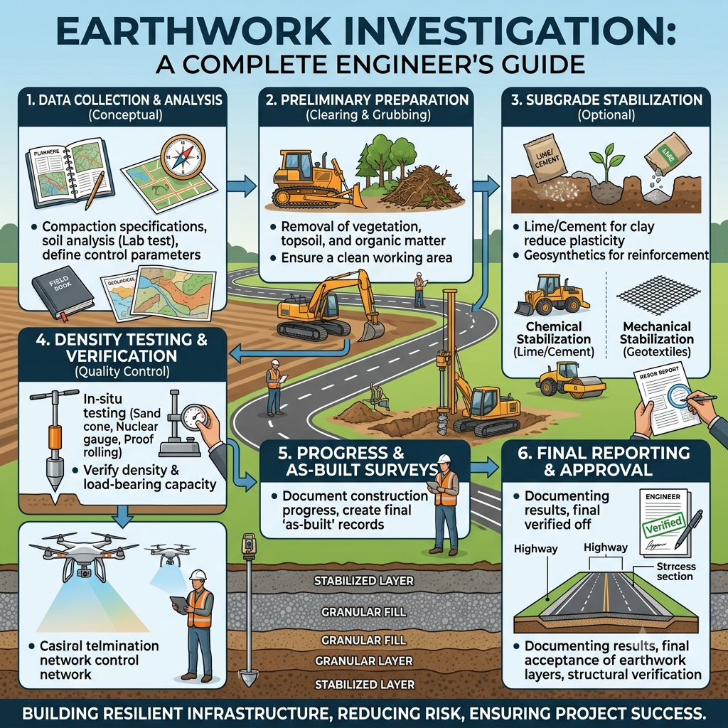
Introduction
Every successful road, highway, railway, airport, or infrastructure project begins with a thorough Earthwork Investigation. Before excavators start cutting hills or compactors begin shaping embankments, engineers must understand the ground conditions, soil properties, and available construction materials. These investigations provide the technical information required to design safe, economical, and durable earthworks.
In highway engineering, earthwork represents one of the largest portions of the construction budget. Poor investigation can result in slope failures, pavement settlement, excessive excavation, drainage problems, and costly redesigns. A detailed investigation minimizes these risks by identifying unsuitable soils, locating borrow areas, estimating excavation quantities, and determining the most efficient construction methods.
This comprehensive guide explains Earthwork Investigation from an engineering perspective, covering its objectives, principles, investigation process, practical applications, field techniques, and best practices. Whether you are a civil engineering student, site engineer, highway consultant, or contractor, understanding earthwork investigation will improve project planning, construction quality, and long-term infrastructure performance.
What is Earthwork Investigation?
Earthwork Investigation is the systematic process of collecting, analyzing, and evaluating field and laboratory data before excavation, embankment construction, or grading begins. It helps engineers understand ground conditions, estimate earthwork quantities, identify suitable construction materials, and develop safe construction methods.
The investigation focuses on both natural ground and proposed construction areas. Engineers examine soil characteristics, groundwater conditions, terrain, and geological features to ensure that the earthwork design performs as intended throughout the project’s service life.
Main Components of Earthwork Investigation
- Site reconnaissance
- Topographic surveying
- Geological assessment
- Soil exploration
- Borrow pit investigation
- Groundwater evaluation
- Earthwork quantity estimation
- Material suitability analysis
Each component provides valuable information that supports accurate design and efficient construction.
Objectives of Earthwork Investigation
The primary goal of earthwork investigation is to collect reliable engineering data before construction begins.
Major Objectives
- Identify existing ground conditions.
- Classify soil and rock types.
- Evaluate soil bearing capacity.
- Locate suitable borrow materials.
- Determine groundwater levels.
- Estimate cut and fill quantities.
- Assess slope stability.
- Recommend suitable construction methods.
- Reduce project risks.
- Improve construction quality.
A detailed investigation allows engineers to make informed decisions rather than relying on assumptions.
Why Earthwork Investigation is Important
Earthwork forms the foundation of every transportation project. Weak or poorly prepared ground can cause pavement distress, differential settlement, erosion, or slope failure.
A proper investigation helps engineers avoid these issues by providing accurate information before construction starts.
Benefits of Earthwork Investigation
- Improves design accuracy.
- Reduces unexpected site conditions.
- Minimizes construction delays.
- Controls project costs.
- Enhances embankment stability.
- Supports proper drainage design.
- Extends pavement service life.
- Improves construction safety.
- Optimizes material utilization.
Practical Example
Imagine a highway project crossing an area with expansive clay. Without investigation, contractors may construct the embankment directly on unsuitable soil. Seasonal moisture changes could then cause swelling, settlement, and pavement cracking.
An earthwork investigation would identify the problem early and allow engineers to stabilize the soil, replace weak material, or redesign the embankment before construction begins.
Engineering Principles of Earthwork Investigation
Every earthwork investigation follows fundamental civil engineering principles that ensure safe and economical construction.
1. Ground Characterization
Engineers identify soil layers, rock formations, groundwater conditions, and natural terrain.
2. Material Suitability
The investigation determines whether excavated material can be reused in embankments or whether additional borrow material is required.
3. Stability Assessment
Engineers evaluate natural and constructed slopes to reduce the risk of landslides or erosion.
4. Drainage Consideration
Groundwater and surface water influence soil strength and long-term performance. Engineers assess drainage conditions during the investigation.
5. Construction Feasibility
The investigation identifies potential challenges such as hard rock excavation, unstable ground, or high groundwater that may affect construction methods.
Earthwork Investigation Process
Step 1: Desktop Study and Project Planning
Every investigation begins in the office before fieldwork starts.
Engineers collect and review existing information to understand site conditions and plan the investigation efficiently.
Information Reviewed
- Topographic maps
- Geological maps
- Satellite imagery
- Previous investigation reports
- Hydrological data
- Existing utilities
- Land use records
- Climatic information
Purpose
The desktop study helps engineers:
- Identify potential problem areas.
- Select investigation locations.
- Estimate fieldwork requirements.
- Reduce unnecessary site visits.
- Plan equipment and personnel.
Proper planning saves both time and construction costs.
Step 2: Site Reconnaissance Survey
The reconnaissance survey provides the first direct assessment of site conditions.
Engineers walk or drive along the proposed alignment while recording important observations.
Field Observations
- Existing ground profile
- Vegetation
- Drainage patterns
- Natural slopes
- Rock outcrops
- Water bodies
- Existing roads
- Buildings
- Utility lines
Practical Benefits
A reconnaissance survey helps engineers identify:
- Potential landslide areas
- Flood-prone locations
- Soft ground
- Borrow material sources
- Environmental constraints
Field observations often reveal conditions that maps cannot accurately show.
Step 3: Topographic Survey
The topographic survey measures the shape and elevation of the ground.
Surveyors collect accurate coordinates that engineers later use for design and earthwork calculations.
Survey Data Collected
- Ground levels
- Contours
- Existing roads
- Rivers
- Culverts
- Buildings
- Trees
- Utility structures
- Property boundaries
Equipment Used
- Total Station
- GNSS/GPS Receivers
- Automatic Level
- Digital Level
- UAV (Drone) Survey Systems
Engineering Importance
Accurate topographic data allows engineers to:
- Design vertical alignment.
- Calculate cut and fill volumes.
- Plan drainage systems.
- Prepare construction drawings.
- Estimate project costs.
Even small survey errors can significantly affect earthwork quantities.
Step 4: Geological Investigation
Geological investigation examines the natural characteristics of the underlying ground.
Engineers study soil deposits, rock formations, faults, and weathering conditions that may influence excavation and embankment construction.
Geological Features Examined
- Rock type
- Soil profile
- Fault zones
- Fractures
- Weathered rock
- Groundwater seepage
- Natural slopes
Why It Matters
Understanding geology helps engineers:
- Select excavation methods.
- Predict blasting requirements.
- Assess slope stability.
- Avoid unstable formations.
- Reduce construction risks.
Projects in mountainous regions require especially detailed geological investigations because changing rock conditions can significantly affect safety and costs.
Step 5: Preliminary Soil Investigation
Soil investigation provides detailed information about the engineering properties of the ground.
Engineers collect representative soil samples for field identification and laboratory testing.
Common Exploration Methods
- Trial pits
- Hand augers
- Boreholes
- Test trenches
- Dynamic Cone Penetrometer (DCP)
- Standard Penetration Test (SPT)
Information Collected
- Soil type
- Moisture condition
- Density
- Layer thickness
- Groundwater depth
- Organic content
- Plasticity
Importance
The results help engineers determine:
- Whether the soil is suitable for embankment construction.
- The level of compaction required.
- The need for soil stabilization.
- The expected performance of the subgrade.
Reliable soil data reduces uncertainty and supports safe, economical earthwork design.
Earthwork Investigation Flow Diagram
Project Planning
        │
        ▼
Desktop Study
        │
        ▼
Site Reconnaissance
        │
        ▼
Topographic Survey
        │
        ▼
Geological Investigation
        │
        ▼
Preliminary Soil Investigation
        │
        ▼
Borrow Area Investigation
        │
        ▼
Field & Laboratory Testing
        │
        ▼
Engineering Recommendations
This sequence ensures that engineers gather complete and reliable information before earthwork operations begin.
Key Takeaways
A successful Earthwork Investigation begins with careful planning, field reconnaissance, accurate surveying, geological assessment, and preliminary soil exploration. These early stages provide the engineering data required to design safe embankments, estimate earthwork quantities, select suitable construction materials, and avoid costly site problems. By identifying potential risks before construction starts, engineers can improve project efficiency, reduce delays, and build durable transportation infrastructure that performs reliably throughout its design life.
Step 6: Borrow Area Investigation
After completing the preliminary soil investigation, engineers evaluate potential borrow areas to identify suitable construction materials for embankments, subgrades, and fill sections. A borrow area is a designated location where soil, sand, gravel, or other earth materials are excavated and transported to the project site.
Selecting a suitable borrow area reduces hauling costs, improves construction efficiency, and ensures the availability of quality materials throughout the project.
Factors Considered During Borrow Area Investigation
- Soil classification
- Material quality
- Moisture condition
- Available quantity
- Haul distance
- Accessibility
- Groundwater conditions
- Environmental impact
- Land ownership
Field Activities
- Trial pit excavation
- Borehole drilling
- Soil sampling
- Visual inspection
- Quantity estimation
- Material classification
Practical Example
Suppose a highway embankment requires 250,000 m³ of fill material. Engineers investigate several borrow areas and select the site that provides suitable soil, shorter hauling distance, lower transportation costs, and minimal environmental disturbance.
Step 7: Earthwork Quantity Estimation
Earthwork quantity estimation calculates the volume of material that must be excavated, transported, reused, or placed during construction.
Accurate quantity calculations help engineers prepare realistic project budgets, construction schedules, equipment plans, and material procurement strategies.
Main Components
Cut Quantity
The volume of soil or rock removed from elevated ground.
Fill Quantity
The volume of material placed to raise low-lying areas or construct embankments.
Borrow Quantity
Additional material required when fill exceeds available excavation.
Waste Quantity
Excess excavation material that cannot be reused.
Common Estimation Methods
- Average End Area Method
- Prismoidal Method
- Digital Terrain Modeling (DTM)
- BIM-Based Quantity Estimation
- GIS-Based Earthwork Analysis
Benefits of Accurate Estimation
- Reduces project cost overruns
- Improves equipment planning
- Minimizes material wastage
- Supports efficient scheduling
- Optimizes truck movements
Modern software enables engineers to generate highly accurate earthwork quantities using digital terrain models and drone survey data.
Step 8: Field and Laboratory Testing
Testing verifies whether soil and construction materials meet the required engineering specifications.
Engineers conduct field tests during site investigations and laboratory tests on collected samples to evaluate engineering properties.
Common Field Tests
Standard Penetration Test (SPT)
Measures soil resistance and estimates bearing capacity.
Dynamic Cone Penetrometer (DCP)
Evaluates subgrade strength quickly in the field.
Field Density Test
Determines whether compacted soil achieves the specified density.
Moisture Content Test
Measures the amount of water present in the soil.
Plate Load Test
Evaluates the load-bearing capacity of the foundation where required.
Common Laboratory Tests
Grain Size Analysis
Determines the distribution of soil particle sizes.
Atterberg Limits
Measures liquid limit, plastic limit, and plasticity index to classify fine-grained soils.
Proctor Compaction Test
Determines the optimum moisture content and maximum dry density for compaction.
California Bearing Ratio (CBR)
Evaluates the strength of subgrade and base materials for pavement design.
Direct Shear Test
Measures the shear strength of soil.
Triaxial Compression Test
Determines soil behavior under different loading conditions.
Consolidation Test
Evaluates settlement characteristics of cohesive soils.
Importance of Testing
Proper testing allows engineers to:
- Select suitable construction materials.
- Design stable embankments.
- Determine compaction requirements.
- Predict long-term performance.
- Reduce construction failures.
Equipment Used in Earthwork Investigation
Modern earthwork investigations rely on advanced surveying and testing equipment to improve accuracy and productivity.
Survey Equipment
- Total Station
- GNSS/GPS Receiver
- Digital Level
- Automatic Level
- Drone (UAV)
- Laser Scanner
Soil Investigation Equipment
- Rotary Drilling Rig
- Hand Auger
- Core Sampler
- Split Spoon Sampler
- Dynamic Cone Penetrometer
- Plate Load Testing Equipment
Laboratory Equipment
- Sieve Shaker
- Compaction Mould
- CBR Testing Machine
- Compression Testing Machine
- Oven
- Moisture Analyzer
- Triaxial Apparatus
Using calibrated equipment improves the reliability of field and laboratory results.
Best Practices for Earthwork Investigation
Following industry best practices improves the quality of investigations and reduces construction risks.
- Begin investigations during the planning stage.
- Conduct detailed desktop studies before fieldwork.
- Use accurate topographic surveys.
- Collect representative soil samples.
- Investigate groundwater conditions thoroughly.
- Verify laboratory results with field observations.
- Perform sufficient boreholes along the alignment.
- Document all field activities carefully.
- Review investigation reports before finalizing the design.
- Update recommendations if site conditions change during construction.
Common Mistakes to Avoid
Many earthwork problems arise because of incomplete investigations or poor engineering decisions.
Avoid these common mistakes:
- Conducting too few boreholes.
- Ignoring seasonal groundwater fluctuations.
- Using untested borrow materials.
- Depending only on visual soil classification.
- Underestimating earthwork quantities.
- Ignoring slope stability.
- Skipping laboratory testing.
- Failing to document field observations.
- Using outdated survey data.
- Overlooking drainage conditions.
Preventing these mistakes improves construction quality and minimizes costly project delays.
Practical Recommendations
Civil Engineers
- Review all investigation reports before starting detailed design.
- Correlate laboratory results with field observations.
- Assess slope stability for cut-and-fill sections.
- Consider future maintenance during earthwork design.
Contractors
- Verify soil conditions before excavation.
- Use approved borrow materials only.
- Maintain optimum moisture content during compaction.
- Monitor field density regularly.
- Protect exposed slopes from erosion during construction.
Engineering Students
- Understand soil classification systems.
- Practice reading borehole logs and geotechnical reports.
- Learn common field and laboratory testing procedures.
- Visit active highway projects to observe earthwork operations.
- Study how investigation results influence design decisions.
General Discussion on IRC, AASHTO, and ICE Practices
International highway engineering organizations emphasize that earthwork investigations should form the foundation of every road project.
In general, recognized engineering practices recommend:
- Conducting detailed topographic, geological, and geotechnical investigations before design.
- Designing embankments based on verified soil properties and anticipated loading conditions.
- Performing laboratory and field testing throughout the investigation process.
- Providing adequate drainage to maintain long-term soil stability.
- Monitoring construction quality through regular inspection and testing.
- Documenting investigation findings thoroughly to support design and construction decisions.
These principles promote safer, more durable, and more economical infrastructure projects.
Frequently Asked Questions (FAQs)
1. What is Earthwork Investigation?
Earthwork Investigation is the process of examining soil, rock, groundwater, and site conditions before excavation or embankment construction to support safe and economical engineering decisions.
2. Why is Earthwork Investigation important in highway construction?
It identifies ground conditions, estimates earthwork quantities, selects suitable construction materials, and reduces the risk of settlement, slope failure, and unexpected construction problems.
3. Which tests are commonly performed during Earthwork Investigation?
Common tests include the Standard Penetration Test (SPT), California Bearing Ratio (CBR), Proctor Compaction Test, Grain Size Analysis, Atterberg Limits, Field Density Test, and Triaxial Compression Test.
4. What is the purpose of a borrow area investigation?
A borrow area investigation identifies suitable sources of soil or aggregate for embankment construction while considering material quality, quantity, haul distance, and environmental impact.
5. How do engineers estimate earthwork quantities?
Engineers use methods such as the Average End Area Method, Prismoidal Method, Digital Terrain Modeling (DTM), and specialized civil engineering software.
6. Which equipment is commonly used during Earthwork Investigation?
Typical equipment includes Total Stations, GNSS receivers, drilling rigs, hand augers, Dynamic Cone Penetrometers, core samplers, drones, and laboratory testing machines.
7. How does groundwater affect earthwork design?
Groundwater reduces soil strength, influences slope stability, affects compaction, and may require drainage or dewatering measures during construction.
8. What are the benefits of detailed Earthwork Investigation?
It improves design accuracy, reduces construction risks, lowers project costs, enhances safety, optimizes material use, and extends the service life of transportation infrastructure.
9. Can unsuitable soil be used in embankment construction?
Engineers may improve unsuitable soil through stabilization with lime, cement, or other additives, or they may replace it with approved material if stabilization is not practical.
10. Who benefits most from understanding Earthwork Investigation?
Civil engineers, highway engineers, contractors, surveyors, geotechnical consultants, project managers, and engineering students all benefit from understanding the investigation process and its impact on construction quality.
Conclusion
Earthwork Investigation serves as the backbone of successful road, highway, railway, and infrastructure development. From desktop studies and field reconnaissance to soil testing, borrow area evaluation, and quantity estimation, every stage provides critical engineering information that supports safe and economical construction. A comprehensive investigation reduces uncertainty, improves design accuracy, minimizes construction risks, and enhances long-term pavement performance. Engineers who invest time in detailed investigations can prevent costly failures, optimize material usage, and deliver durable infrastructure that performs reliably under changing traffic and environmental conditions. Whether you are a student, contractor, or experienced highway engineer, mastering Earthwork Investigation will strengthen your technical knowledge and contribute to the successful planning and execution of modern transportation projects.
