
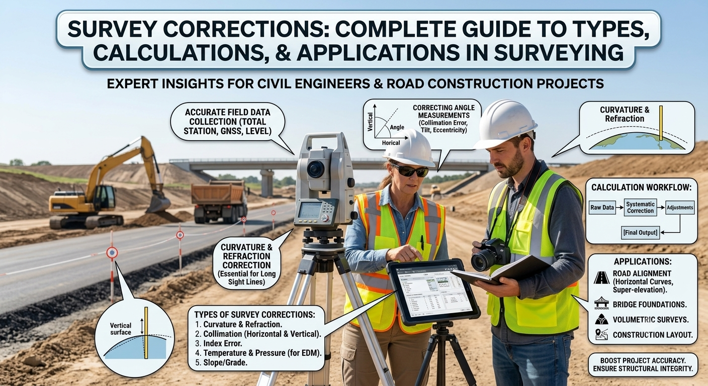
Introduction
Accurate measurements form the foundation of every successful engineering project. Whether engineers design highways, bridges, railways, canals, or buildings, they rely on precise survey data to make informed decisions. Even a small measurement error can create alignment problems, increase construction costs, or reduce structural safety. Surveyors therefore apply Survey Corrections to eliminate or minimize unavoidable measurement errors and achieve reliable results.
Survey corrections compensate for physical conditions, instrument limitations, environmental factors, and human influences that affect measured distances and elevations. These corrections help engineers convert observed measurements into standardized values suitable for design and construction.
Understanding Survey Corrections is essential for civil engineers, transportation engineers, contractors, surveyors, and engineering students. This guide explains the principles, types, practical applications, engineering significance, and best practices related to survey corrections using simple language and real-world examples.
What Are Survey Corrections?
Survey Corrections are mathematical adjustments applied to measured distances, elevations, or angles to compensate for known errors caused by instruments, environmental conditions, or field situations.
Surveyors rarely collect measurements under perfect conditions. Steel tapes expand in hot weather, sag under their own weight, stretch due to excessive tension, and follow sloping ground instead of horizontal lines. Engineers apply suitable corrections to remove these effects and produce accurate measurements.
Definition
Survey corrections are calculated values that surveyors add to or subtract from observed measurements to obtain the true or standard value.
Purpose of Survey Corrections
Survey corrections help engineers:
- Improve measurement accuracy.
- Maintain project quality.
- Reduce cumulative errors.
- Achieve precise highway alignment.
- Produce reliable topographic maps.
- Support accurate construction layout.
- Minimize costly rework during construction.
Why Survey Corrections Are Important
Modern infrastructure projects demand high precision. Even a few millimeters of error can become significant over several kilometers of highway alignment.
For example, if a survey team measures a 5 km highway centerline without applying appropriate corrections, the accumulated error may shift the road alignment enough to affect earthwork quantities, drainage structures, bridge locations, and property boundaries.
Applying survey corrections provides several benefits:
- Higher surveying accuracy
- Better project quality
- Improved geometric design
- Reliable construction staking
- Reduced project costs
- Enhanced safety
- Compliance with engineering standards
Survey corrections therefore play a critical role in every stage of road and highway development.
Survey Errors vs Survey Corrections
Many beginners confuse survey errors with survey corrections. Although closely related, they represent different concepts.
| Survey Errors | Survey Corrections |
|---|---|
| Unwanted deviations during measurement | Mathematical adjustments applied to remove known errors |
| Occur due to instruments, environment, or human factors | Improve measurement accuracy |
| Cannot always be avoided | Can usually be calculated and applied |
| Affect survey precision | Restore measurements closer to true values |
Understanding this difference helps engineers select the correct correction method for each surveying situation.
Types of Survey Corrections
Surveyors apply different corrections depending on the source of the error. The most common corrections used in civil and highway engineering are discussed below.
1. Correction for Standardization
Every surveying tape has a standard length established during manufacturing or calibration. Over time, wear, stretching, or damage may change the actual tape length.
If the tape becomes longer or shorter than its nominal length, every measured distance contains a proportional error.
Why It Is Necessary
Standardization correction compensates for differences between the actual tape length and the nominal tape length.
Practical Example
Suppose a 30 m tape has stretched and now measures 30.015 m.
Every measurement taken with this tape will be slightly longer than the true distance. Applying the correction restores measurement accuracy.
Engineering Applications
- Highway centerline surveys
- Boundary surveys
- Bridge setting out
- Control surveys
- Topographic mapping
2. Temperature Correction
Steel tapes expand when temperature increases and contract when temperature decreases.
If surveyors ignore this effect, measured distances become inaccurate.
Engineering Principle
Steel expands because heat increases the spacing between its molecules.
The amount of expansion depends on:
- Temperature difference
- Tape length
- Coefficient of thermal expansion
Practical Example
A steel tape calibrated at 20°C measures a highway alignment during a hot afternoon at 40°C.
The tape becomes slightly longer, causing the observed distance to appear shorter than the actual ground distance. Temperature correction compensates for this difference.
Factors Affecting Temperature Correction
- Ambient temperature
- Tape material
- Calibration temperature
- Measurement length
Where Engineers Apply It
- Long highway surveys
- Railway alignment
- Dam construction
- Airport runways
- Canal projects
3. Pull (Tension) Correction
Surveyors apply a specific pulling force when measuring distances with steel tapes.
If the applied pull differs from the standard pull used during tape calibration, the tape stretches by a different amount.
Why Pull Matters
A higher pull stretches the tape, making it longer.
A lower pull shortens the effective measuring length.
Both situations affect measurement accuracy.
Practical Example
During highway construction, one survey crew applies 50 N while another applies 80 N to the same tape.
Without pull correction, the two crews produce different measurements for the same distance.
Best Practice
Always use a spring balance or tension handle to maintain uniform pull during measurement.
4. Sag Correction
Steel tapes rarely remain perfectly horizontal between two supports.
Their own weight causes the tape to sag, forming a curve rather than a straight line.
Since the curved tape measures a longer distance than the true horizontal distance, surveyors apply sag correction.
Engineering Principle
Gravity causes unsupported tapes to hang in a catenary shape.
The greater the unsupported span, the larger the sag.
Practical Example
While measuring across a shallow valley, surveyors support the tape only at its ends.
The tape sags under its own weight.
Without sag correction, the recorded distance exceeds the actual horizontal distance.
Reducing Sag
Surveyors can reduce sag by:
- Increasing support points
- Applying proper pull
- Using shorter spans
- Using Electronic Distance Measurement (EDM) equipment
5. Slope Correction
Surveyors often measure distances along sloping ground instead of perfectly level surfaces.
Road design, however, requires horizontal distances.
Slope correction converts measured slope distances into equivalent horizontal distances.
Why It Matters
Highway alignment, land boundaries, and earthwork calculations all depend on horizontal distances rather than sloping measurements.
Practical Example
A survey team measures a 200 m distance on a hillside.
Although the tape records 200 m, the true horizontal distance is slightly shorter.
Applying slope correction provides the correct value for engineering design.
Common Applications
- Mountain highways
- Railway routes
- Pipeline projects
- Hill road surveys
- Canal alignment
Practical Engineering Example
Consider a proposed national highway passing through rolling terrain.
Surveyors perform distance measurements using a steel tape during summer conditions.
Several factors influence the observations:
- High temperature expands the tape.
- Uneven terrain introduces slope errors.
- Long unsupported spans create sag.
- Variable pulling force stretches the tape.
Instead of accepting the observed measurements directly, engineers apply the required survey corrections to obtain standardized horizontal distances. These corrected values support accurate route alignment, pavement design, bridge positioning, and quantity estimation.
Survey Corrections Diagram
                  Observed Distance
                         │
                         ▼
          ┌─────────────────────────┐
          │ Survey Corrections       │
          └─────────────────────────┘
        ┌────────┬────────┬────────┐
        ▼        ▼        ▼        ▼
 Standard  Temperature  Pull    Sag
 ization                  │
        └────────┬────────┘
                 ▼
          Slope Correction
                 │
                 ▼
        Correct Horizontal Distance
6. Alignment Correction
Alignment correction becomes necessary when the measuring tape or survey line does not follow the exact straight line between two survey stations. Even a slight deviation can produce inaccurate distance measurements, especially on long highway and railway projects.
Why Alignment Correction Matters
Every engineering design depends on precise linear measurements. If the tape shifts away from the true alignment, the measured distance becomes longer than the actual straight-line distance.
Common Causes
- Obstacles such as trees or rocks
- Poor ranging between survey stations
- Inexperienced survey staff
- Uneven terrain
- Wind affecting tape position
Practical Example
During the preliminary survey of a highway, vegetation blocks the direct line of sight. The survey team measures along a slightly curved path instead of the true centerline. Alignment correction removes the resulting error and restores the correct horizontal distance.
Best Practices
- Use ranging rods to maintain a straight alignment.
- Remove unnecessary obstacles before measurement.
- Verify alignment before recording observations.
- Employ Total Station or GNSS equipment for high-precision projects.
7. Mean Sea Level (MSL) Correction
Surveyors often measure long distances on elevated terrain. Since the Earth’s radius changes with elevation, distances measured above mean sea level differ slightly from equivalent distances at sea level.
For short construction projects, this difference remains negligible. However, long highway corridors, railway alignments, and national mapping projects require Mean Sea Level correction.
Why MSL Correction Is Required
Higher elevations produce slightly longer measured distances because the measurements occur farther from the Earth’s center.
Applications
- National highway surveys
- Railway corridors
- State control surveys
- Geodetic networks
- Long-distance pipeline projects
Engineering Benefit
Applying MSL correction ensures consistency between field measurements and mapping coordinate systems.
8. Curvature Correction
The Earth has a curved surface rather than a perfectly flat one. Over long distances, this curvature influences leveling observations and survey accuracy.
Curvature correction compensates for the Earth’s spherical shape.
Importance
Ignoring curvature can introduce noticeable errors in precise leveling and long-distance engineering surveys.
Typical Applications
- Highway leveling
- Bridge approaches
- Canal construction
- Dam projects
- Geodetic surveys
Engineering Principle
As the survey distance increases, the Earth’s surface gradually falls away from a horizontal line of sight. Engineers apply curvature correction to account for this geometric effect.
9. Refraction Correction
Atmospheric conditions affect the path of light passing between surveying instruments and targets.
Changes in temperature, pressure, and air density bend light rays slightly, causing observed levels or distances to differ from their true values.
This phenomenon is known as atmospheric refraction.
Factors Affecting Refraction
- Air temperature
- Atmospheric pressure
- Humidity
- Time of day
- Solar radiation
Practical Example
Surveyors working across a hot asphalt pavement during midday may experience stronger atmospheric refraction than during early morning observations.
Best Practices
- Conduct precise leveling during cooler periods.
- Avoid observations over heated surfaces.
- Balance backsight and foresight distances.
- Repeat measurements when atmospheric conditions fluctuate.
10. Electronic Distance Measurement (EDM) Corrections
Modern highway projects rely heavily on Electronic Distance Measurement (EDM) devices, Total Stations, and GNSS equipment.
Although these instruments provide exceptional accuracy, environmental conditions still influence their measurements.
Common EDM Corrections
- Temperature correction
- Atmospheric pressure correction
- Humidity correction
- Instrument calibration correction
- Prism constant correction
Advantages of EDM Technology
- Faster measurements
- Higher precision
- Reduced human error
- Improved productivity
- Digital data storage
- Seamless integration with CAD and GIS software
Modern surveying equipment automatically applies several corrections, but engineers should always verify calibration and environmental settings before beginning fieldwork.
Engineering Applications of Survey Corrections
Survey corrections support nearly every stage of civil engineering and infrastructure development.
Highway Engineering
- Centerline surveys
- Horizontal and vertical alignment
- Earthwork calculations
- Pavement layout
Railway Engineering
- Track alignment
- Gradient control
- Curve setting
Bridge Construction
- Foundation positioning
- Pier alignment
- Deck layout
Dam Engineering
- Control surveys
- Reservoir mapping
- Structural monitoring
Urban Development
- Property boundary surveys
- Utility mapping
- Building layout
Best Practices for Applying Survey Corrections
Professional surveyors achieve high accuracy by following disciplined field procedures.
Recommended Practices
- Calibrate instruments regularly.
- Inspect measuring tapes before fieldwork.
- Record weather conditions during observations.
- Apply appropriate corrections immediately after measurements.
- Verify calculations independently.
- Maintain detailed field notes.
- Use modern surveying instruments whenever practical.
- Repeat critical measurements for quality assurance.
- Train survey teams on standardized procedures.
- Follow project specifications and quality management systems.
Practical Recommendations
Civil Engineers
- Review survey reports before finalizing designs.
- Verify correction calculations for long-distance projects.
- Coordinate with survey teams during route selection.
- Maintain proper documentation for future reference.
Contractors
- Confirm survey control points before construction.
- Protect benchmarks from damage.
- Avoid disturbing established reference stations.
- Verify layout measurements before excavation.
Engineering Students
- Understand the purpose of each survey correction rather than memorizing formulas.
- Practice field measurements using standard surveying equipment.
- Compare corrected and uncorrected distances to appreciate their impact.
- Study real highway survey case studies to strengthen practical knowledge.
General Discussion of IRC, AASHTO, and ICE Practices
Leading engineering organizations such as the Indian Roads Congress (IRC), AASHTO (American Association of State Highway and Transportation Officials), and the Institution of Civil Engineers (ICE) emphasize accuracy throughout the surveying process.
Their guidance generally encourages engineers to:
- Perform detailed control surveys before design.
- Calibrate instruments at regular intervals.
- Apply necessary survey corrections to field observations.
- Maintain complete survey documentation.
- Verify measurements through independent checks.
- Follow established quality assurance procedures.
- Use appropriate surveying technology for project requirements.
- Minimize cumulative errors during data collection.
Following these principles improves the reliability of survey data and supports the successful delivery of highway and infrastructure projects.
Survey Correction Workflow Diagram
Field Measurement
        │
        ▼
Identify Error Source
        │
        ▼
Select Appropriate Correction
        │
        ▼
Apply Mathematical Adjustment
        │
        ▼
Verify Corrected Values
        │
        ▼
Engineering Design & Construction
Frequently Asked Questions (FAQs)
1. What are survey corrections?
Survey corrections are mathematical adjustments applied to measured distances, angles, or elevations to compensate for known errors and improve accuracy.
2. Why are survey corrections important in highway engineering?
They provide accurate survey data for alignment, pavement design, drainage planning, bridge positioning, and construction layout, reducing costly errors.
3. What is the difference between survey errors and survey corrections?
Survey errors represent deviations from the true value, while survey corrections are calculated adjustments that reduce or eliminate those deviations.
4. Which survey correction is applied for sloping ground?
Slope correction converts measured slope distances into equivalent horizontal distances required for engineering design.
5. Why does temperature affect steel tape measurements?
Steel expands in high temperatures and contracts in low temperatures, changing the tape length and influencing measured distances.
6. What causes sag correction?
The weight of a suspended tape creates a curved profile between supports. Sag correction compensates for the additional measured length caused by this curve.
7. Do modern Total Stations eliminate survey corrections?
Modern instruments automatically account for several environmental factors, but engineers still need to verify calibration, atmospheric settings, and measurement procedures.
8. When is Mean Sea Level correction required?
MSL correction is important for long-distance surveys, geodetic control networks, national highway projects, and large infrastructure developments where elevation affects measured distances.
9. Which industries rely heavily on survey corrections?
Highway engineering, railway construction, bridge engineering, airport development, mining, pipeline installation, dam construction, and land development all depend on accurate survey corrections.
10. How can surveyors reduce measurement errors?
Surveyors can reduce errors by calibrating instruments, using standardized procedures, maintaining proper alignment, applying appropriate corrections, recording environmental conditions, and performing independent verification.
Conclusion
Accurate surveying forms the backbone of every successful civil engineering project, and Survey Corrections ensure that field measurements truly reflect ground conditions. Corrections for standardization, temperature, pull, sag, slope, alignment, mean sea level, curvature, refraction, and electronic distance measurement each address specific sources of error that can affect design accuracy. Applying these corrections improves highway alignment, structural positioning, quantity estimation, and construction quality while reducing costly rework and safety risks. Engineers, surveyors, contractors, and students who understand these principles can make better technical decisions and deliver projects with greater confidence. By combining careful field practices, regular instrument calibration, modern surveying technology, and guidance from recognized engineering organizations such as IRC, AASHTO, and ICE, professionals can consistently produce reliable survey data. Mastering Survey Corrections is not only essential for precise measurements but also for building durable, safe, and efficient transportation infrastructure that meets modern engineering standards.
