
Introduction
Survey calculations form the backbone of every successful civil engineering project. Every road, highway, bridge, railway, dam, airport, and building depends on accurate measurements and precise mathematical calculations before construction begins. Even a small calculation error can shift an alignment, increase project costs, delay construction, or create long-term structural problems.
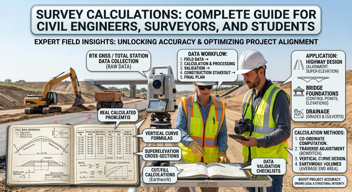
Survey calculations transform field measurements into reliable engineering data. Engineers use these calculations to determine distances, elevations, coordinates, bearings, areas, volumes, and earthwork quantities. Modern surveying equipment such as Total Stations, GNSS receivers, digital levels, drones, and laser scanners improves measurement accuracy, but engineers still rely on correct calculations to verify field data and produce dependable designs.
Whether you are a civil engineer, highway designer, contractor, surveyor, or engineering student, understanding Survey Calculations helps you deliver safer, more accurate, and cost-effective infrastructure projects. This guide explains the fundamental calculation methods, engineering principles, practical applications, and industry best practices used in modern surveying.
What Are Survey Calculations?
Survey calculations are mathematical processes that convert field observations into usable engineering information. Surveyors measure distances, angles, elevations, and positions in the field, while calculations transform those measurements into coordinates, layouts, contours, and construction data.
These calculations support nearly every stage of an infrastructure project, including:
- Route selection
- Highway alignment
- Bridge location
- Building layout
- Land subdivision
- Earthwork estimation
- Utility mapping
- Construction setting out
Without accurate survey calculations, engineers cannot prepare reliable drawings or execute projects within specified tolerances.
Why Survey Calculations Matter
Every construction project begins with reliable survey data. Accurate calculations improve project quality and reduce costly mistakes.
Key Benefits
- Improve positional accuracy.
- Reduce construction errors.
- Support precise road alignment.
- Minimize material wastage.
- Simplify quantity estimation.
- Improve construction efficiency.
- Ensure compliance with project specifications.
- Reduce project risks.
Practical Example
Imagine a highway centerline shifts by only 150 mm because of incorrect coordinate calculations. That small error can affect pavement width, drainage structures, bridge approaches, utility crossings, and property boundaries. Correct survey calculations prevent such problems before construction starts.
Basic Principles of Survey Calculations
Professional surveyors follow several engineering principles to maintain accuracy throughout the project.
Accuracy
Measurements should satisfy project accuracy requirements. Highway projects generally require much higher precision than preliminary land surveys.
Consistency
Survey teams should use the same coordinate system, datum, units, and calculation methods throughout the project.
Verification
Engineers should verify field measurements through independent observations and mathematical checks.
Error Adjustment
No survey is completely free from error. Surveyors identify, distribute, and minimize errors using accepted adjustment techniques.
Documentation
Every calculation should be clearly documented to support future verification, design revisions, and construction activities.
Types of Survey Calculations
Survey calculations cover several engineering applications. Each calculation serves a specific purpose during planning, design, and construction.
1. Chainage Calculations
Chainage represents the distance measured along the centerline of a road, railway, pipeline, or canal from a fixed starting point.
Engineers use chainage to locate structures and construction activities accurately.
Applications
- Road centerline layout
- Culvert locations
- Bridge positions
- Utility crossings
- Drainage structures
- Pavement marking
Example
Suppose the starting point is Chainage 0+000.
A culvert located 850 meters from the starting point will have:
Chainage = 0+850
A bridge located 2,450 meters away becomes:
Chainage = 2+450
This notation allows engineers and contractors to communicate locations efficiently on site.
2. Bearing and Azimuth Calculations
Bearings and azimuths define the direction of survey lines.
Bearing
A bearing measures the angle between a survey line and the north or south direction.
Example:
N 35° E
Azimuth
An azimuth measures clockwise from north and ranges between:
0° to 360°
Example:
215°
Why Bearings Matter
Engineers use bearings for:
- Traverse surveys
- Highway alignment
- Property boundary surveys
- Construction setting out
- Control surveys
Example
If a survey line has an azimuth of 120°, its direction lies in the southeast quadrant.
3. Coordinate Calculations
Coordinate calculations determine the exact position of survey points on a map or construction site.
Most modern surveys use Easting (X) and Northing (Y) coordinates.
Coordinate Formula
For a known distance (D) and bearing (θ):
- ΔE = D × sin θ
- ΔN = D × cos θ
The coordinates of the next point become:
- Easting = Previous Easting + ΔE
- Northing = Previous Northing + ΔN
Practical Example
Known Point:
Easting = 1500.000 m
Northing = 2400.000 m
Distance = 100 m
Bearing = 30°
Calculated values:
ΔE = 50 m
ΔN = 86.60 m
New Coordinates:
Easting = 1550.000 m
Northing = 2486.600 m
Coordinate calculations form the basis of GPS surveys, Total Station observations, and GIS mapping.
4. Distance Calculations
Surveyors determine horizontal distances before preparing maps or construction layouts.
Methods
- Steel tape measurement
- Electronic Distance Measurement (EDM)
- Total Station
- GNSS
- Laser measurement
Slope Correction
When measurements occur on sloping ground, engineers convert slope distance into horizontal distance.
Horizontal Distance = Slope Distance × cos(Slope Angle)
This correction improves mapping accuracy and layout precision.
5. Angle Calculations
Angles establish the geometry of survey networks.
Surveyors commonly measure:
- Horizontal angles
- Vertical angles
- Deflection angles
- Interior angles
- Exterior angles
Applications
- Traverse surveys
- Road alignment
- Building layout
- Bridge construction
- Property boundary surveys
Accurate angle measurements help engineers maintain correct alignment throughout construction.
Practical Applications of Survey Calculations
Survey calculations support nearly every civil engineering discipline.
Highway Engineering
- Centerline setting out
- Curve design
- Chainage calculations
- Cross-section preparation
- Earthwork estimation
Building Construction
- Foundation layout
- Grid establishment
- Structural positioning
- Column alignment
Railway Projects
- Track alignment
- Gradient calculations
- Curve setting
- Station layout
Water Resources Engineering
- Canal alignment
- Dam surveys
- Reservoir mapping
- Irrigation planning
Urban Development
- Land subdivision
- Utility mapping
- Smart city planning
- Property boundary surveys
Engineering Diagram
Basic Traverse Survey
                Point B
                  ●
                 / \
                /   \
     Bearing   /     \ Distance
              /       \
             /         \
      Point A ●---------● Point C
           Known      Calculated
         Coordinates  Coordinates
Coordinate System
             North (+Y)
                 ↑
                 │
                 │
                 │
West (-X) ───────┼──────── East (+X)
                 │
                 │
                 │
                 ↓
            South (-Y)
Chainage Illustration
0+000 -------- 0+500 -------- 1+000 -------- 1+500 -------- 2+000
 Start         Culvert        Bridge        Junction        Project End
Key Takeaways
Survey calculations provide the mathematical foundation for accurate planning, design, and construction in civil engineering. Chainage, bearings, coordinates, distances, and angle calculations enable engineers to establish precise layouts, maintain correct alignments, and reduce construction errors. By following sound surveying principles and verifying field data, professionals can improve project quality, minimize risks, and ensure reliable infrastructure development. Mastering these fundamental calculations prepares engineers and students for advanced topics such as leveling, traverse adjustment, earthwork estimation, and curve calculations, which will be covered in Part 2.
6. Level Calculations
Level calculations determine the elevation of points relative to a known benchmark. Engineers rely on these calculations to establish road grades, drainage slopes, building foundations, and earthwork profiles.
The two most common methods are the Height of Instrument (HI) Method and the Rise and Fall Method.
Height of Instrument (HI) Method
The HI Method calculates the elevation of unknown points by adding the backsight reading to the benchmark elevation.
Formula
- Height of Instrument = Benchmark Elevation + Backsight
- Reduced Level (RL) = Height of Instrument − Foresight
Example
Benchmark RL = 100.000 m
Backsight = 1.450 m
Height of Instrument = 101.450 m
Foresight = 0.950 m
Reduced Level = 100.500 m
This method offers speed and simplicity, making it suitable for large construction projects.
Rise and Fall Method
The Rise and Fall Method determines whether each point is higher or lower than the previous point.
Formula
- Rise = Previous Staff Reading − Current Staff Reading
- Fall = Current Staff Reading − Previous Staff Reading
- New RL = Previous RL + Rise − Fall
Advantages
- Detects calculation errors easily.
- Provides complete checking at every station.
- Produces highly reliable leveling records.
Engineers often use this method for precise engineering surveys where accuracy is critical.
7. Traverse Calculations and Adjustment
A traverse consists of connected survey lines whose lengths and directions are measured to establish control points.
Small measurement errors can accumulate during fieldwork, creating a closing error. Engineers adjust the traverse to distribute these errors systematically.
Components of Traverse Calculations
- Traverse length
- Bearings
- Angles
- Latitude
- Departure
- Closing error
Common Adjustment Methods
- Bowditch (Compass Rule)
- Transit Rule
- Least Squares Adjustment
Importance
Traverse adjustment:
- Improves coordinate accuracy.
- Reduces cumulative errors.
- Produces reliable control networks.
- Supports accurate highway and bridge layouts.
8. Area Calculations
Surveyors calculate land areas for property boundaries, highway corridors, reservoirs, construction sites, and land acquisition.
Common Methods
Coordinate Method
Suitable for irregular boundaries.
Trapezoidal Rule
Widely used for cross-sections and earthwork calculations.
Simpson’s Rule
Provides greater accuracy for curved boundaries.
Practical Applications
- Highway right-of-way
- Land subdivision
- Agricultural surveys
- Construction planning
- Compensation calculations
Accurate area calculations help engineers prepare reliable project estimates and legal documentation.
9. Earthwork Volume Calculations
Earthwork estimation determines the quantity of excavation and embankment required during construction.
This calculation directly influences project cost, equipment selection, and construction scheduling.
Common Methods
Average End Area Method
This method calculates the average of two consecutive cross-sectional areas and multiplies it by the distance between them.
Prismoidal Formula
The prismoidal formula provides greater accuracy when the ground profile changes significantly between sections.
Applications
- Highway embankments
- Canal excavation
- Railway formation
- Building site development
- Dam construction
Engineering Importance
Accurate earthwork calculations:
- Reduce material wastage.
- Improve cost estimation.
- Optimize equipment utilization.
- Balance cut and fill quantities.
10. Curve Calculations
Roads and highways rarely follow perfectly straight alignments. Horizontal and vertical curves provide smooth transitions, improve safety, and enhance driving comfort.
Horizontal Curve Elements
- Radius
- Tangent length
- Curve length
- Central angle
- External distance
- Middle ordinate
Vertical Curve Elements
- Gradient
- Curve length
- High point
- Low point
- Sight distance
Applications
- Highway geometric design
- Railway alignment
- Airport runways
- Urban road networks
Proper curve calculations ensure safe vehicle operation and compliance with design standards.
Common Survey Calculation Mistakes
Even experienced surveyors can make calculation errors if proper procedures are not followed.
Frequent Mistakes
- Using incorrect units of measurement.
- Recording field observations inaccurately.
- Entering incorrect bearings or coordinates.
- Ignoring instrument calibration.
- Failing to check traverse closure.
- Using inconsistent coordinate systems.
- Applying incorrect slope corrections.
- Skipping independent verification of calculations.
Early identification of these mistakes prevents costly construction errors.
Best Practices for Accurate Survey Calculations
Professional surveyors achieve reliable results by following proven engineering practices.
- Calibrate surveying instruments regularly.
- Verify field observations before leaving the site.
- Maintain consistent units and coordinate systems.
- Check calculations using independent methods.
- Record field notes clearly and systematically.
- Use reliable survey software for complex computations.
- Protect benchmarks and control points.
- Perform quality assurance throughout the project.
- Back up digital survey data regularly.
- Review calculations before issuing final drawings.
Practical Recommendations
Civil Engineers
- Verify survey control before starting design work.
- Cross-check coordinates against project drawings.
- Review leveling records before approving construction.
- Coordinate closely with geotechnical and highway design teams.
Contractors
- Confirm construction control points before setting out.
- Avoid relying on a single survey observation.
- Protect established benchmarks during construction.
- Report discrepancies immediately.
Engineering Students
- Practice manual calculations before using software.
- Learn the principles behind every surveying formula.
- Understand field procedures as well as office computations.
- Participate in practical surveying exercises whenever possible.
General Discussion of IRC, AASHTO, and ICE Practices
Leading engineering organizations emphasize the importance of precision, quality assurance, and standardized procedures in surveying.
General recommendations include:
- Establish permanent survey control before design.
- Use accurate and calibrated surveying equipment.
- Verify field observations through independent checks.
- Maintain complete survey documentation.
- Apply recognized coordinate systems and datums.
- Conduct regular quality control during data processing.
- Integrate survey results with design and construction teams.
- Preserve benchmarks throughout the project lifecycle.
Following these principles helps engineers deliver reliable and durable infrastructure projects.
Frequently Asked Questions (FAQs)
1. What are survey calculations?
Survey calculations convert field measurements into engineering information such as coordinates, elevations, distances, areas, and volumes used for planning, design, and construction.
2. Why are survey calculations important in civil engineering?
They provide accurate data for road alignments, building layouts, earthwork estimation, drainage design, and infrastructure development while reducing construction errors.
3. What is chainage in surveying?
Chainage represents the measured distance along the centerline of a road, railway, or canal from a fixed starting point.
4. What is the difference between bearing and azimuth?
Bearing expresses direction relative to the north or south, while azimuth measures direction clockwise from north through 360 degrees.
5. Which leveling method is more accurate?
The Rise and Fall Method provides better checking and error detection, whereas the Height of Instrument Method offers faster calculations for routine projects.
6. Why is traverse adjustment necessary?
Traverse adjustment distributes unavoidable measurement errors, improving the accuracy of calculated coordinates and control points.
7. How are earthwork quantities calculated?
Engineers commonly use the Average End Area Method and the Prismoidal Formula to estimate excavation and embankment volumes.
8. Which instruments support modern survey calculations?
Total Stations, GNSS receivers, digital levels, laser scanners, drones, and surveying software all improve measurement accuracy and processing efficiency.
9. How can engineers reduce survey calculation errors?
Regular instrument calibration, accurate field observations, independent calculation checks, and consistent coordinate systems significantly reduce errors.
10. Are manual survey calculations still important?
Yes. Modern software performs calculations quickly, but engineers must understand the underlying principles to verify results, identify errors, and make informed engineering decisions.
Conclusion
Survey Calculations form the mathematical foundation of every successful civil engineering and road construction project. From determining chainages, coordinates, and elevations to estimating earthwork quantities and designing highway curves, accurate calculations guide every stage of planning, design, and construction. Modern surveying equipment has improved efficiency, but engineering judgment and a strong understanding of calculation principles remain essential for producing reliable results. Civil engineers, surveyors, contractors, and students who master these techniques can reduce costly errors, improve project quality, and ensure compliance with accepted engineering practices. By combining careful field observations, systematic verification, and standardized calculation methods, professionals can deliver safe, durable, and cost-effective infrastructure. Developing expertise in Survey Calculations not only strengthens technical skills but also builds confidence in solving complex engineering challenges across transportation, structural, and land development projects.
