
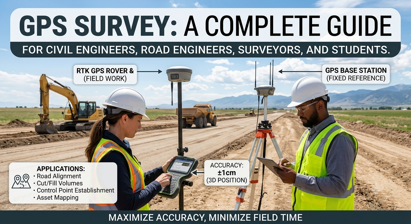
Modern infrastructure projects demand precise positioning, accurate measurements, and efficient data collection. Traditional surveying methods, while reliable, often require significant time, manpower, and line-of-sight visibility between survey points. The introduction of GPS Survey technology has transformed the surveying industry by enabling engineers to determine positions with remarkable accuracy using satellite signals.
Today, GPS surveying is widely used in road construction, highway alignment, bridge construction, land development, topographic mapping, and geospatial data collection. Whether establishing project control points or conducting route surveys for highways, GPS technology provides fast, reliable, and highly accurate positioning that improves project efficiency and reduces construction costs.
Understanding GPS Survey is essential for civil engineers, road engineering consultants, contractors, and engineering students because it has become a standard tool in modern infrastructure development. This guide explains the principles, components, methods, applications, and engineering significance of GPS surveying while highlighting practical examples and industry best practices.
What is GPS Survey?
A GPS Survey is a surveying method that uses signals transmitted by Global Positioning System (GPS) satellites to determine the precise three-dimensional position of points on the Earth’s surface.
Unlike conventional surveying methods that depend on measuring angles and distances between visible points, GPS surveying determines location by calculating the distance between satellites and a GPS receiver. This allows surveyors to establish coordinates quickly and accurately, even across large project areas.
GPS surveying provides three primary coordinates:
- Latitude
- Longitude
- Elevation (Height)
These coordinates serve as the foundation for engineering design, mapping, construction layout, and infrastructure development.
Definition
A GPS Survey is the process of determining the exact location of points using satellite-based positioning technology to support engineering, mapping, and construction activities.
Why GPS Surveying is Important
GPS technology has significantly improved the speed and accuracy of engineering surveys.
Its importance continues to grow because modern infrastructure projects demand precise positioning data throughout planning, design, construction, and maintenance.
Benefits of GPS Survey
- High positioning accuracy
- Faster field data collection
- Reduced manpower requirements
- Minimal dependence on line-of-sight observations
- Improved productivity
- Better digital mapping capabilities
- Reliable data for engineering design
- Easy integration with GIS and CAD software
For large highway projects, GPS surveying can reduce survey time from several weeks to only a few days while maintaining excellent accuracy.
How GPS Survey Works
GPS surveying relies on a network of satellites orbiting the Earth.
Each satellite continuously broadcasts signals containing:
- Satellite position
- Time of transmission
- Navigation information
A GPS receiver captures signals from multiple satellites simultaneously.
Using the travel time of these signals, the receiver calculates the distance to each satellite. Through a mathematical process called trilateration, the receiver determines its exact location on Earth.
Basic Working Principle
The GPS receiver requires signals from at least four satellites to accurately calculate:
- Easting
- Northing
- Elevation
- Time
The more satellites available, the higher the reliability and accuracy of the position.
Engineering Principle
GPS positioning depends on:
- Satellite geometry
- Signal travel time
- Speed of radio waves
- Precise atomic clocks
- Mathematical coordinate computation
Accurate positioning is achieved by minimizing errors caused by atmospheric conditions, satellite clock variations, and signal reflections.
Components of a GPS Survey System
A GPS survey system consists of several integrated components that work together to produce accurate positioning data.
1. GPS Satellites
The satellite constellation forms the space segment of the GPS system.
Each satellite continuously broadcasts timing and positional information to receivers on the ground.
Functions
- Transmit positioning signals
- Provide precise timing
- Maintain orbital information
- Support continuous global coverage
2. GPS Receiver
The GPS receiver is the primary field instrument used by surveyors.
It receives signals from multiple satellites and computes the coordinates of the survey point.
Modern receivers provide centimeter-level accuracy when used with advanced surveying techniques such as RTK or Static GPS.
Features
- Multi-frequency reception
- High accuracy
- Digital data storage
- Wireless communication
- GIS compatibility
3. Control Station
Ground control stations continuously monitor GPS satellites and update their orbital information.
These stations improve positioning accuracy by correcting satellite errors.
Responsibilities
- Satellite monitoring
- Orbit correction
- Clock synchronization
- Signal integrity verification
4. Survey Controller
A survey controller is a handheld device connected to the GPS receiver.
It enables surveyors to:
- Configure surveys
- Record observations
- Store coordinates
- Display maps
- Perform quality checks
- Transfer project data
5. Data Processing Software
Collected GPS observations are processed using specialized software.
The software performs:
- Coordinate adjustment
- Error correction
- Network balancing
- Map generation
- Export to CAD and GIS platforms
Examples of outputs include:
- Topographic maps
- Contour plans
- Digital terrain models (DTMs)
- Coordinate reports
- Construction layout files
Types of GPS Survey
Different surveying projects require different GPS techniques depending on the desired accuracy, project size, and field conditions.
Static GPS Survey
Static GPS surveying provides the highest level of positioning accuracy.
Receivers remain stationary over known and unknown points for extended observation periods, typically ranging from 20 minutes to several hours.
Common Uses
- National control networks
- Bridge monitoring
- Geodetic surveys
- Large infrastructure projects
Advantages
- Highest accuracy
- Excellent reliability
- Suitable for long baselines
Rapid Static Survey
Rapid Static surveying follows the same principle as static surveying but requires much shorter observation times.
Typical occupation times range from 5 to 20 minutes depending on baseline length.
Suitable Applications
- Engineering control surveys
- Construction projects
- Utility mapping
Kinematic GPS Survey
In kinematic surveying, the receiver moves continuously while collecting positional data.
Coordinates are recorded at regular intervals as the surveyor walks or drives through the project area.
Applications
- Highway route surveys
- Railway surveys
- Pipeline alignment
- Corridor mapping
This method allows rapid collection of large quantities of spatial data.
Real-Time Kinematic (RTK) Survey
RTK surveying is one of the most widely used GPS methods in civil engineering.
It employs a base station and a rover receiver to provide real-time centimeter-level positioning.
Advantages
- Immediate results
- High accuracy
- Faster construction layout
- Efficient stakeout operations
Engineering Applications
- Road centerline setting out
- Earthwork measurement
- Building layout
- Utility installation
- Bridge construction
Differential GPS (DGPS)
Differential GPS improves positioning accuracy by applying correction data from a nearby reference station.
Although less precise than RTK, DGPS is highly effective for navigation, mapping, and general engineering surveys.
Typical Uses
- Topographic mapping
- Environmental studies
- Coastal surveys
- Asset management
Applications of GPS Survey in Civil and Road Engineering
GPS surveying has become an indispensable tool throughout the lifecycle of infrastructure projects.
Highway Engineering
GPS is used for:
- Route reconnaissance
- Highway alignment
- Centerline establishment
- Earthwork calculations
- Construction stakeout
Road Construction
Engineers rely on GPS for:
- Setting control points
- Grade verification
- Pavement alignment
- Utility coordination
Bridge Engineering
Applications include:
- Pier positioning
- Structural monitoring
- Deformation analysis
- Construction control
Land Development
GPS surveying supports:
- Property boundary surveys
- Site grading
- Utility mapping
- Urban planning
Mining and Quarrying
GPS technology assists in:
- Volume calculations
- Machine guidance
- Stockpile measurement
- Mine planning
GIS and Mapping
Data integrates seamlessly with Geographic Information Systems (GIS) to produce accurate digital maps, terrain models, and asset inventories.
GPS Survey Workflow Diagram
         GPS Satellites
      🛰️    🛰️    🛰️
          \    |    /
           \   |   /
            \  |  /
         GPS Receiver
               │
               ▼
      Survey Controller
               │
               ▼
   Data Processing Software
               │
               ▼
 Engineering Drawings, GIS Maps,
  Topographic Plans & Reports
GPS Survey Process Flow
Project Planning
        │
        ▼
Control Point Setup
        │
        ▼
GPS Data Collection
        │
        ▼
Data Processing
        │
        ▼
Coordinate Verification
        │
        ▼
CAD / GIS Mapping
        │
        ▼
Engineering Design
Key Takeaways
A GPS Survey is one of the most valuable technologies in modern civil and road engineering, providing accurate, efficient, and reliable positioning for infrastructure projects. By using satellite-based navigation, engineers can establish control points, conduct topographic surveys, perform construction stakeout, and create precise digital maps with greater speed than traditional methods. Understanding the working principles, system components, survey techniques, and practical applications of GPS surveying equips engineers, contractors, and students with the knowledge needed to execute projects more effectively. In the next part, we will explore the step-by-step GPS survey procedure, advantages, limitations, engineering best practices, practical recommendations, IRC/AASHTO/ICE guidance, FAQs, and a comprehensive conclusion.
Advantages of GPS Survey
GPS surveying has revolutionized the way engineers collect spatial data by providing exceptional accuracy, efficiency, and flexibility. Compared to conventional surveying methods, it significantly reduces field time while delivering highly reliable coordinate information.
1. High Accuracy
Modern GPS surveying techniques, particularly Real-Time Kinematic (RTK) and Static GPS, can achieve centimeter-level accuracy when properly implemented. This precision is essential for road alignment, bridge construction, and engineering control networks.
2. Faster Data Collection
Large project areas that once required several days of conventional surveying can often be completed within a few hours using GPS technology. This improvement increases productivity and reduces project schedules.
3. Reduced Workforce Requirements
GPS surveying generally requires fewer personnel than traditional methods because measurements can be collected without maintaining line-of-sight between survey points.
4. Excellent Performance Over Long Distances
Unlike conventional traversing, GPS maintains high positioning accuracy across extensive project corridors such as highways, railways, and pipelines.
5. Digital Integration
GPS data can be imported directly into:
- CAD software
- GIS platforms
- Building Information Modeling (BIM)
- Machine Control Systems
- Digital Terrain Models (DTM)
This integration minimizes manual data entry and reduces the possibility of transcription errors.
Limitations of GPS Survey
Although GPS surveying offers numerous advantages, engineers should also understand its limitations.
Signal Obstruction
Dense forests, tunnels, tall buildings, and steep valleys can block satellite signals, reducing accuracy or preventing observations.
Multipath Errors
Satellite signals reflected from buildings, water surfaces, or metallic structures may reach the receiver through indirect paths, introducing positioning errors.
Atmospheric Effects
Variations in the ionosphere and troposphere can slightly delay satellite signals, affecting measurement accuracy.
Dependence on Satellite Visibility
Reliable positioning requires sufficient satellite coverage and favorable satellite geometry.
Equipment Cost
Professional-grade GPS receivers, controllers, and processing software involve significant initial investment, although long-term productivity often offsets these costs.
Step-by-Step GPS Survey Procedure
A successful GPS survey follows a structured workflow to ensure consistent and accurate results.
Step 1: Project Planning
Before entering the field, surveyors define:
- Project objectives
- Required accuracy
- Survey area
- Coordinate system
- Equipment requirements
- Observation method
Proper planning minimizes delays and improves survey efficiency.
Step 2: Reconnaissance
The survey team visits the site to identify suitable control point locations and assess potential challenges.
During reconnaissance, surveyors evaluate:
- Satellite visibility
- Accessibility
- Nearby obstructions
- Safety conditions
- Existing survey monuments
Step 3: Establishing Control Points
Control points provide reference coordinates for the entire project.
These points should be:
- Stable
- Easily accessible
- Protected from disturbance
- Clearly documented
Accurate control points are essential for reliable survey results.
Step 4: GPS Equipment Setup
The GPS receiver is mounted securely over the survey point using a tripod or survey pole.
Important setup checks include:
- Instrument centering
- Pole height measurement
- Battery status
- Receiver configuration
- Coordinate system selection
Incorrect setup can introduce systematic errors throughout the survey.
Step 5: Data Collection
Survey observations are collected according to the selected survey method.
During this stage, surveyors monitor:
- Number of visible satellites
- Position dilution of precision (PDOP)
- Signal quality
- Observation duration
- Receiver status
Maintaining high-quality observations improves overall positioning accuracy.
Step 6: Data Processing
Field observations are transferred to specialized software for processing.
Typical processing tasks include:
- Error correction
- Coordinate computation
- Baseline adjustment
- Network balancing
- Quality assessment
Processed coordinates are then exported for engineering design and mapping.
Step 7: Quality Verification
Engineers verify the final coordinates before using them for construction or design.
Quality control may include:
- Repeat observations
- Closure checks
- Coordinate comparisons
- Statistical analysis
- Independent verification
Reliable quality assurance reduces the risk of costly construction errors.
Common Sources of GPS Survey Errors
Even advanced GPS systems are affected by various error sources. Understanding these errors helps surveyors apply appropriate corrective measures.
Satellite Errors
Minor inaccuracies in satellite orbital information or onboard clocks can affect positioning.
Receiver Errors
Improper calibration, damaged antennas, or incorrect configurations may reduce accuracy.
Atmospheric Delays
Signal travel time changes as radio waves pass through different atmospheric layers.
Human Errors
Incorrect antenna heights, poor equipment setup, or inadequate field procedures can introduce avoidable mistakes.
Environmental Factors
Nearby buildings, trees, cliffs, and reflective surfaces may cause signal interference or multipath effects.
Best Practices for GPS Survey
Following established best practices improves survey accuracy and reliability.
- Conduct a site reconnaissance before fieldwork.
- Use well-maintained and calibrated equipment.
- Select observation periods with favorable satellite geometry.
- Avoid areas with excessive signal obstructions where possible.
- Measure antenna heights accurately.
- Record detailed field notes.
- Perform redundant observations on critical control points.
- Process data using approved software and verified coordinate systems.
- Store backup copies of all survey data.
- Verify final coordinates before construction begins.
Practical Recommendations
Civil Engineers
- Confirm project coordinate systems before starting fieldwork.
- Integrate GPS data with total station surveys where higher local precision is required.
- Review processed coordinates before issuing construction drawings.
- Maintain comprehensive documentation for future reference.
Road Engineering Contractors
- Establish permanent control points before earthwork begins.
- Recheck critical layout points regularly during construction.
- Protect survey monuments from accidental damage.
- Coordinate closely with survey teams to avoid construction delays.
Engineering Students
- Understand the principles of satellite positioning rather than relying solely on equipment operation.
- Practice both static and RTK surveys to appreciate their respective applications.
- Learn data processing techniques using professional survey software.
- Study common GPS errors and methods of minimizing them.
General Discussion of IRC, AASHTO, and ICE Practices
Although project requirements vary between countries, internationally recognized highway engineering organizations such as IRC, AASHTO, and ICE generally support the use of modern positioning technologies for infrastructure development.
Their guidance emphasizes:
- Establishing accurate survey control before design and construction.
- Using reliable geospatial data for highway alignment and mapping.
- Maintaining consistent coordinate reference systems throughout the project.
- Implementing quality assurance procedures for survey observations.
- Verifying survey data before construction activities commence.
- Maintaining comprehensive documentation of survey methods and results.
Following these widely accepted engineering principles helps improve project accuracy, construction efficiency, and long-term infrastructure performance.
Frequently Asked Questions (FAQs)
1. What is a GPS Survey?
A GPS Survey is a surveying technique that uses satellite signals to determine the precise position of points on the Earth’s surface for engineering, mapping, and construction purposes.
2. How accurate is GPS surveying?
Accuracy depends on the survey method. Static and RTK GPS surveys can achieve centimeter-level accuracy under favorable conditions, while standard GPS provides lower precision suitable for navigation and general mapping.
3. What is the difference between GPS and DGPS?
Standard GPS determines position directly from satellite signals, whereas Differential GPS (DGPS) uses correction data from a reference station to improve positioning accuracy.
4. Where is GPS surveying commonly used?
GPS surveying is widely applied in highway engineering, road construction, bridge projects, land development, mining, utility mapping, agriculture, and GIS data collection.
5. Can GPS surveying replace conventional surveying?
GPS surveying complements rather than completely replaces traditional methods. Total stations and levels remain valuable where satellite signals are obstructed or where very high local precision is required.
6. What equipment is required for a GPS survey?
A typical GPS survey requires satellite receivers, antennas, survey controllers, tripods or poles, batteries, communication devices (for RTK), and data processing software.
7. What factors reduce GPS accuracy?
Signal obstructions, multipath reflections, poor satellite geometry, atmospheric conditions, receiver setup errors, and incorrect antenna height measurements can reduce positioning accuracy.
8. What is RTK GPS surveying?
Real-Time Kinematic (RTK) surveying uses a base station and a rover receiver to provide real-time, centimeter-level positioning for engineering and construction applications.
9. Why are control points important in GPS surveys?
Control points provide stable reference coordinates that ensure consistency and accuracy throughout the survey and construction process.
10. Is GPS surveying suitable for highway projects?
Yes. GPS surveying is extensively used for route reconnaissance, control establishment, alignment design, construction stakeout, earthwork measurement, and asset management in highway engineering.
Conclusion
A GPS Survey has become an indispensable component of modern civil and road engineering because it delivers accurate positioning, efficient data collection, and seamless integration with digital design and mapping systems. From highway alignment and bridge construction to land development and topographic mapping, GPS technology enables engineers to complete surveying tasks with greater speed and precision than many traditional methods. However, achieving reliable results requires more than advanced equipment; it also depends on proper planning, sound field procedures, rigorous quality control, and a thorough understanding of satellite positioning principles. Engineers, contractors, and students who master GPS surveying techniques are better equipped to improve project accuracy, reduce construction risks, and support informed decision-making throughout the infrastructure lifecycle. As positioning technology continues to evolve alongside GIS, BIM, drones, and machine guidance systems, the role of GPS Survey will become even more significant in shaping efficient, sustainable, and high-quality engineering projects.

Kamran Malik is a passionate civil engineering writer and researcher who specializes in construction, transportation, structural engineering, and infrastructure topics. Through his articles on CivilEngineerings.com, he simplifies complex engineering concepts and shares practical insights, industry trends, and educational resources for students, professionals, and engineering enthusiasts.